Map Kibera Trust at the 7th ESRI East African User Conference

by: October 29th, 2012 comments: 1

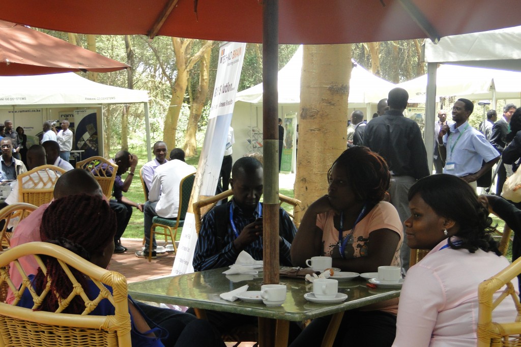
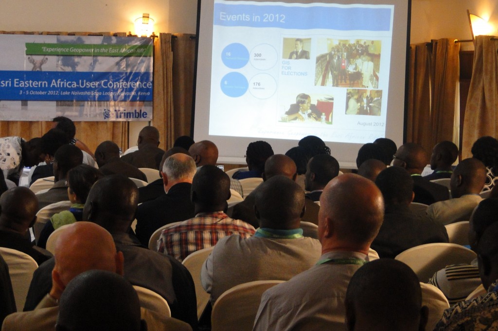
First we would like to thank ESRI East Africa for giving us the opportunity to be part of their 7th user conference. The Map Kibera Trust members present at the conference were Zachariah Muindi and Maureen Omino. This year’s theme was “Experience Geopower in the East African Rift” and the choice of the venue was great because it was just in line with the theme of the year, with it being located in the Rift Valley, on the shores of Lake Naivasha, with the Olkaria geothermal power station just a few km away, providing a good site to go for the conference safari.

The conference was just a wonderful experience that created a conducive environment for networking, sharing and learning with participants from different parts of the world, from different organizations and institutions.. The sessions were so awesome, interactive and educative. The opening session was graced by the Permanent Secretary of the Ministry of Land, who shared the changes that have taken place in the ministry thanks to GIS. Most of the maps that the ministry had were so outdated and the introduction of GIS to the ministry was a major boost to creation and publishing of new maps and constant updating of the maps. In one way the Ministry of Land affects a lot of ministries in Kenya therefore if wrong and outdated data is dished out automatically it will affect the services provided by the other ministries.

We would also like to congratulate the different organizations that scooped this year’s award at the User Conference for their outstanding job. This is clear enough that the use of the mapping has brought a huge relief to many organizations, government ministries, municipalities’ problems. The sessions at the conference were divided into two; there was the industrial sessions that focused on the applicability of ArcGIS to come up with solutions for different issues that affect human settlements, wildlife, nature e.t.c.

My colleague Maureen presented (slides here) in one of the sessions on mapping slum areas using OpenStreetMap and ArcGIS. She explained the whole work that we have been doing as a Trust starting from our Kibera pilot project, to the work that we have done in Mathare and finally on the current work that we are doing in Mukuru, and how we use GIS in creating and publishing our maps. The feedback after the presentation was just great. We also prepared and presented a paper at the conference that explained in detail the work that we have done in Kibera, Mathare and especially in Mukuru. It highlights the whole process that we undertook from the word go in Mukuru, from identifying the area, organizing community forums, to data collection and editing the data and the creation and publishing of the final maps.

There was also a presentation on crime mapping and analysis using a web based portal by Simon Ngegi Njuguna, where he shared how technology can be introduced to the police department to curb the rising issues of insecurity. Web based platforms can engage the public to report any incidence of insecurity, and once the report is sent to the police it can be analyzed and be published to the public as a warning, be used to communicate with the police on the ground about the exact location of the incidence and the easiest and fastest way they can reach there. And I do believe if this is implemented it would be a milestone to the police department that would help them serve the public efficiently and protect them. More details check out the presentation.

From the conference we learnt that there are other ArcGIS services that we can in cooperate in the work that we doing as Map Kibera, apart from the one that we have been using to create maps. We can also work with ESRI East Africa and see how they can help us bring in the new system where we saw with the use of a simple smartphone you can collect data from the field, send it to someone who is in the office, and he can analyze the data prepare a map using the data and publish to the public and other key stakeholders that are associated with information. We think this could be helpful for us as a Trust, especially now that we are starting the project on election monitoring.

Director’s Diary: Combatting Development Chaos

by: October 26th, 2012 comments: 0

Kepha Ngito is Executive Director of Map Kibera Trust. This post is his first in a series of personal reflections on his experiences with Map Kibera.

The Accra effect

Recently I attended the ON (Omidyar Network) -Baraza together with the African Leadership Network conference in Accra, Ghana. Both events happened one after the other at the same venue, the Movenpick Hotel. Irony is that I found peace of mind to write down these thoughts while in a 5-star hotel in Accra, Ghana, and not in a tin, stick and mud shack in the heart of Kibera, Mathare or Mukuru slums in Nairobi. These last 3 locations are normally my dwelling places, not just physical dwellings but psychological dwellings and lately, professional dwellings. I was only a visitor in Ghana, a country with a lot of history.

Being in Ghana or say, the comforts of the hotel ironically provided a certain ‘peace’ of mind and quiet – a rare luxury for most people living in slums — that enabled me to reflect enough to write this article. Even though I don’t compare myself to those in prison or exile, I understood why they write better and longer articles.

For nearly 10 months now, I have been working as the Executive Director at Map Kibera Trust. I am also one of the founding Trustees of the organization. A quick attention grabber would be that we worked with the community to make the first digital map of Kibera and ‘placed’ it on the Kenyan map after decades of its depiction as a forest on the country’s official map. We have since done the same for Mathare and Mukuru.

With a team of about 45 people (15 in each location), we are a group of people who believe that mapping is the first step to affirming that a people exist somewhere, even when they have been pushed to the periphery of mainstream development and tagged as ‘informal’ or depicted as a forest, a quarry site, a swamp, an electricity reserve or a garbage dump site in official maps. For many years, over 60% of Nairobi residents who reside in the many slums in and around the city have occupied the ‘non –formal’ residential areas and built what is now known as ‘informal settlements.’ Putting them on the map physically, then socially, then economically and even politically by encouraging an information-driven culture of advocacy is what we have been working at in the last 2 and half years of our existence. In this way, we attempt to ‘formalize the informal’. It’s a pity that some people’s identities are carved for them by others and by circumstances beyond their control. Where we live or lived does not necessarily make us who we are. We believe that we are not products of our environment, we are the creators of it, we sustain its beauty or unbeauty and that’s why we must be the people to change what’s wrong about it.

‘Development’ chaos in the slums

Even as I waited eagerly to interact with other invited leaders from different parts of Africa and the world at the Accra conference, I couldn’t help but reflect at the journey we have made in Kibera, Mathare and now in Mukuru. This was a journey aimed at increasing the spaces of transparency, establishing credible information and data and making it open and accessible to people. Offering marginalized residents alternative citizen platforms to voice their own stories (see Kibera News Network or Voice of Kibera), making maps, updating them regularly and teaching people how to use them to discuss development issues at community level. Slums are like oceans with many things that cannot be discovered at a glance.

For many years, NGOs and organizations with good intentions swarmed into the slums each armed with a silver bullet – a philosophy that they strongly believed in. These projects were usually too brief to make any meaningful or sustainable effects in the community. They also had very fine points of focus with very strict statistical deliverables and timelines mostly targeting large amounts of quantitative data as the main outputs. As a result, beyond the beautiful statistics, published project reports and nice photos shared among their elite donors and ‘partners’, nothing much of substance came to or remained with the people when these projects came to an end. (Usually they tended to leave as soon as the project money ran out). This ‘development chaos’ characterized by competition for space, donor funds and the community’s goodwill led to the loss of professional integrity, lack of consistency and loss of the urge to network among like-minded initiatives. Corruption found a breeding ground and boom!, a ‘virtual slum’ was created, a slum made famous for the wrong reasons and constructed by NGOs and aid organizations whose ideas have failed to build the community and who have created idle structures that stand in the way of and frustrate new practical methods, ideas or development. And  while all this is happening, the real slums and their challenges remain in the shadows wallowing in ignorance, poverty, disease and crime, and watch every day as a new truck passes by full of visiting ‘partners’. The mama mboga sits at the same roadside mud kiosk every day and barely manages to turn away her face to avoid the camera flash glare. She probably wonders why some people are so interested in her picture. She can only complain by turning her head away.

Rising Voices coverage of Map Kibera

by: August 3rd, 2012 comments: 0

Andrea Arzaba with Yvonne Tiany in Mathare

As mentioned in a previous post, we were privileged to have guests from Global Voices visiting the Kibera and Mathare programs on July 1. The intention wasn’t only to share Map Kibera with them, but to work together on some interesting local stories for Rising Voices and our own media sites.

Rising Voices is a great initiative by Global Voices to “extend the benefits and reach of citizen media by connecting online media activists around the world and supporting their best ideas.” The authors of the posts below are part of this project and come from all corners of the globe, where they blog about important local issues. For many of them, the opportunity to travel to the Global Voices Summit is a rare chance to see this part of the world and learn about how Kenyans are practicing citizen journalism like themselves.

Five fantastic posts have so far been written by our visitors, who explored topics in Mathare and Kibera that were of interest to them. One great summary post written by the director of Rising Voices, Eddie Avila, sums up the experience.

Here are some great Flickr photo sets from our visitors, too:

Kibera photos by Laura Schneider.

Mathare photos by Andrea Arzaba.