by: jamie January 30th, 2012 comments:
In 2010, Map Kibera was awarded a Youth Fund grant from Unhabitat. With the many developments in the Map Kibera project, the

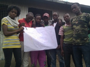
Mildred and Mukuru residents with hand-drawn village boundraies (photo credit: Primoz Kovacic)
Youth Fund grant was delayed until mid-2011. Some of the other initiatives the team was working on included the establishment of the local agency Map Kibera Trust, with support from the Africa Technology and Transparency Initiative and the expansion to work (led by Map Kibera Trust ) to Mathare and Kwale.
Map Kibera Trust received the Unhabitat youth fund grant in order to expand its work to other parts of Nairobi. Given the existing ties with Mukuru (an informal settlement in Nairobi’s industrial area) and the demand for training from young people who had been introduced to mapping in 2009 and 2010, the mappers decided to implement the youth fund grant in Mukuru.
The Unhabitat youth fund grant is designed to support organizations led by young people in developing countries. The grant involves a component of skills development; young people from selected organizations are trained in project management, documentation and budgeting. The young people then put their newly acquired skills into action throughout the project lifecycle.
Primoz and I have been supporting the mappers in Kibera, however we believe the best way to learn is through experience. And so in order to see them develop the new skills, we have taken a step back and supported the project mainly through some limited technical assistance. The field work and documentation has been led by Mildred Anekeya, the mapper coordinator (herself a young mapper from Kibera) and Vincent Mutuku and Moses Wahor, young mappers from Mukuru.
Below is a question and answer from Mildred, Vincent and Moses that documents their experiences in mapping Mukuru during the first half of the youth fund grant cycle. Â Their insights are important to those undertaking similar projects in similar contexts. These answers were submitted to Unhabaitat as part of a mid-term report.
What is the progress you have made [in mapping Mukuru]?
First of all we held two successful community forums, in Mukuru kwa Reuben and Mukuru Kayaba, which sensitized the community on the importance of mapping before we launched it. Finally we will hold other forums to confirm the mapping that we have done to the community.
We were been able to cover all five villages of Mukuru which are Mukuru kwa Njenga, Mukuru kwa Rueben, Mukuru Lungalunga, Sinai and Mukuru kayaba. We were able to train 24 trainees in data collection which involved usage of GPS gadgets, downloading the data, editing and uploading it which involved gaining of computer knowledge. We had problems like getting approval from the local authorities but we had to convince on what to implement on the ground and later they had to approve us. We also faced minor problems from the participants which are commitment towards the training and some were demanding allowance for their time, but after giving them the importance of the training they had to commit themselves fully. Insecurity was also one the problems but we had to find ways to curb it, and this was to work the residents from the same village.
What problems have you encountered during the first phase of the project?
At first we encountered problems from the administration, allowances of the trainees they were not ready to work without being paid, insecurity especially in Mukuru Kayaba and lack of commitment from the trainees especially Mukuru Kayaba where initially we had about 12 trainees and they all left remaining with 4. The obstacles that we faced in technical issues were: too few computers which led to extension of the timeframe and also it took time for the participants to catch up with what we were teaching them. Less internet modems which lead to limited internet access.
How did you overcome these problems?
Coordinators from Mukuru had to talk to the administration concerning the project and convince them for approval. They also coordinated and made the availability of the trainee to training centre. They ensured security was intact and organized for the venues. This made the mapping process run smoothly despite the challenges. Concerning technical issues we had to make use of what we had at hand and the administration of the Map Kibera Trust made sure that we full credits for the modems and the computers were available each time we needed them.
What project activities are planned for the next 6 months?
Drawing of boundaries of the villages and their zones, drawing of paths and tracks, drawing the industries and also showing how they are close to residential areas which can be used to explain some of the risks that people in slums are prawn to, like in the case of Sinai tragedy.
Finalizing on the mapping process and ensuring that the trainees are able to comprehend what we taught them.
Making follow up on all the stakeholders that would be interested in using the final maps in their work groups such as Administration, Youth, women groups, trainees, Community based and Faith based organizations.
To understand the spread of development in every particular village and also make conclusion on how the developments could be enhanced.
Any other comments?
The mapping exercise is a very unique method of bringing out problems in informal settlements; hence it should be enhanced to cover all the slums in Kenya. The trainees will need to have ongoing exercises less they forget what they learned, this can be improved by having substations in Mukuru.
by: jamie September 15th, 2011 comments:

Training youth mappers in Mukuru
It’s not if but when, And the when took place this Monday morning. A KPC pipeline – that runs through Nairobi’s informal settlement of Mukuru – exploded, taking with it the lives of 95+ people who live, work, school and play near in one of the marginal areas of the sprawling metropolis of Nairobi city.
Kenyans have been discussing the pipeline disaster and have been analyzing the factors that led up to the event. On Tuesday, both the Standard and the Daily Nation ran 11 pages of coverage of the event. It’s not surprising that journalists have in the past covered the precarious situation residents of the Sinai village face. There is often coverage of other dangerous conditions Nairobi residents live in – such as those living along the railway or high voltage power line in Kibera, or the polluted river in Mathare, or the dumping site in Dandora.
Many are not aware that the Sinai village (referred to in the media as Sinai slum or Lunga Lunga slum) is one village in the larger informal settlement of Mukuru. Mukuru is located in Nairobi’s industrial area. Access to the area is facilitated by roads that lead along the backs of factories and warehouses and industrial workvsites. The dangers of living in Mukuru slum are apparent as factories bellow out smoke, trucks carrying hazardous materials rumble by and pipes and electrical towers dot the landscape.
For the past 2 months, the Map Kibera Trust team have been working with youth in Mukuru. The “Map Mukuru†project began with funding from Unhabitat’s Youth Fund and interest from young people in Mukuru who we had worked with in 2010, with funding from HIV Free Generation.
The Map Kibera team has been engaged is a long-term process of skills building for young people in Nairobi’s informal settlements of Kibera, Mathare and now Mukuru. The Mukuru project is being run almost entirely by young mappers from Kibera – we’ve taken the opportunity of receiving the youth fund grant to push the Kibera youth to manage the project on their own and to exchange skills and learn from other young people.

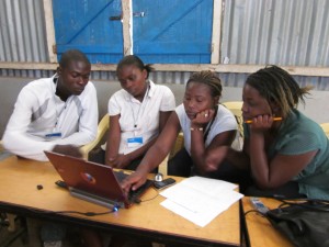
Maureen Omino from Kibera trains mappers in Mukuru
The team is saddened by the tragic event in Sinai. The event hit some of our mappers quite hard – they were in the field in the area of the blast the previous week and were thankful that we were inside, editing data at the time of the explosion. None of the mappers were injured during the explosion but some lost friends in the fire and we send our condolences to the families and friends of the victims.
Our mapping work however is not a reaction to any singular event – it is a long-term effort aimed at amplifying the voices of residents of informal settlements. Our mission is to increase their representation and influence in decision making processes. By training young people as mappers and digital storytellers, we hope we are contributing to community resilience, not just to respond to disasters like the Sinai fire tragedy, but to ultimately reduce the risk to resident in informal settlements through identifying solutions to ongoing problems and dangers in the local environment.
by: jamie August 1st, 2011 comments:
You may have seen a lot of action from @PrimozKovacic today on Twitter. That’s because Map Kibera is set to facilitate Map Mukuru!
In 2010, Map Kibera worked with HIV Free Generation and Emory University to offer training in GPS data collection and OpenStreetMap (OSM) tools to youth engaged in health asset mapping. In previous years, the HIV Free Generation and Emory team had worked with a large mapping firm to produce maps of health assets in the area. The team soon realized that capacity for data collection and mapping of the area needed to be built locally – enter Map Kibera.
Our team facilitated a brief 3 day training and followed up with some data collection and OSM support in the following weeks. During that time, we were impressed by the enthusiasm and skills of the youth in Mukuru (view their work in OSM here).
In late 2010, when the Map Kibera mappers were awarded a UNHABITAT Youth Fund grant we immediately thought of Mukuru. We had kept in touch with Vincent Mutuku and Moses Wahor, two of the star mappers from Mukuru. They had been asking when we could come back to Mukuru. We reached out to them again and they were excited to continue mapping their community.
Mukuru is made up of 3 distinct areas – Mukuru kwa Ruben, Mukuru kwa Njenga and Kayaba. The 2010 mapping only focused on Mukuru kwa Njenga and the health assets in that area. Our challenge for the coming months is to map the entire 3 areas based on community priorities.
The first planning meeting for Map Mukuru was held on 29th June 2011 at Map Kibera office. The meeting was attended by Vincent and Moses (the two Mukuru coordinators), Kibera Mappers and Map Kibera management.
During the meeting, the team discussed the steps in the mapping process. Based on our experience in Kibera and Mathare, we identified the following questions and ideas:
- What are we going to do?
- We should involve community leaders who know the location
- We need to have community meetings to identify their views and priorities
- We need equipment and supplies eg GPS, computers, stationary.
- We need a base of operation (or 2-3 bases because of the size of Mukuru)
- Identify the number of mappers in Mukuru  (again, based on the size of the area)
- Number of local coordinators – we have 2 so far!
- Decide on a Time frame – (which is 5 months as outlined in the Youth Fund proposal)
- Be sure to gather feedback from the community after the first mapping
- We need to print maps and distribute them to the community (Hard copies)
We agreed that the Kibera mappers will provide overall leadership, experience and training, but the people of Mukuru people will map their own villages.
Between June 29th and August 1st, Vincent and Moses identified two operational bases in Mukuru (at Goal Kenya and St. Mary’s Church).  They also set about mobilizing important stakeholders, including the local administration in the area (District Commissioners, District Officers, Chiefs). They also approached over 100 youth groups, NGOs and women’s groups in the areas to determine their interest in the mapping project. All the community mobilization efforts paid off and the 1st community forum today attracted 150 guests! We’ll be holding a second forum on Friday.
Keep your eyes on the blog for further updates.


