Mike: “Karibu Huruma. You want some tea?” Me: “Is it safe here?” Mike: “Don’t worry, you’re very safe here!”

Huruma
In order to encourage participation of as many residents of Mathare as possible, we’re continuing with a rotating venues approach. We are trying to get different groups to host us so we can be closer to the communities, where the participants then explain in detail to all interested parties, from elders to children to grandmothers, what they’re doing, why we’re there and why there are some people walking around with strange telephones (GPS units). We also want to enable our participants to walk to the trainings and not spend their money on public transportation.
Working from different parts of Mathare has another importance: on-site discussion around the biggest needs of the particular community leads to on-site recognition of the particular problem. This then leads to determining what exactly they want on the map, what they would need the map for, and therefore what the focus should be. All this information will be crucial in making good thematic maps which will show the biggest and most immediate needs of the particular area.
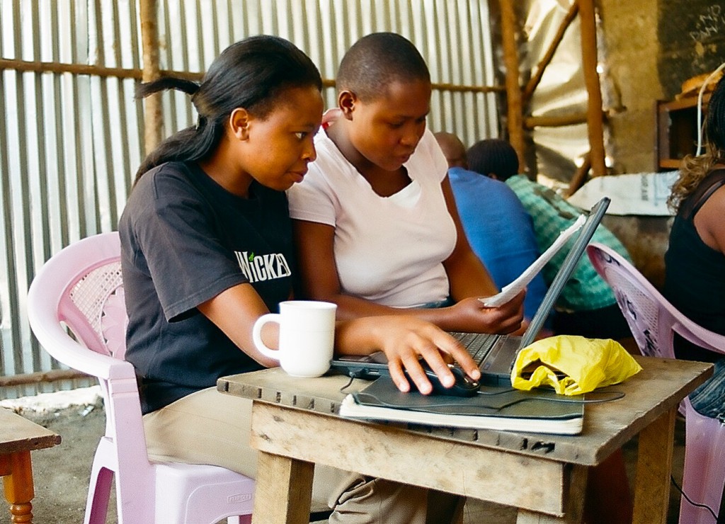
Huruma Trainings
Resident: “People rarely come to these areas; we don’t get any attention like Kibera does; NGOs don’t come here and don’t care about this place; Mathare is very poor; there is almost no development. We say United Nations is for the people who work there, not for us. Aren’t you afraid?” Me: “Should I be?” Resident: “Not if you’re with this crew. That’s very good what you’re doing!”
I still feel afraid every time I step out of the cab with 4 computers and 10 GPS units that someone will knock me over the head with a rock. However, they never let me out of their sight. Even when I go to the toilet someone is standing in front of the door. I feel they are keeping a close eye on us and the programs. They’ve had too many disappointments with projects that failed or didn’t live up to their expectations. We understand these issues and are working hard in Kibera to recognize our mistakes and make sure that we live up to the expectations of our team there (more on this coming soon).
So Jamie and I, with advice from Sammy from Plan Kenya and Simon from Ngoza Njia – Community Development Center, approached Mathare by taking a massive amount of responsibility from our shoulders and handing over most of the decision making to Mathare residents. It’s them who decide what they want on the map, for what purpose they want to use the map, what they want to document with video, where the next venue should be, who to invite to public discussions, how to engage other people to participate, how to make these tools useful to as many as possible etc. From the start we presented our programs as Mathare’s own programs, something no one can dictate or tell them what to do with it. We can already see it and they’re taking ownership. The conversation is often like this, resident: “So you’re going to map all the CBOs in the community?” Me: “I don’t know, you tell me!”

Trainings
Last week (24. Jan – 30. Jan) we worked in 3 locations in Mathare. The mappers were focusing on the eastern part of Mathare – Huruma, Kiamaiko, New Mathare and Mathare Nort. We were hosted by Ngoza Njia – Community Development Center situated between Huruma B and Kiamaiko. From there the teams spread out and mapped the hell out of Huruma. We collected approximately 200 points in two hours of field work.
On Thursday we were hosted by Vision Youth Group in Huruma – Ngei1 area, where we edited the data collected on the previous day.
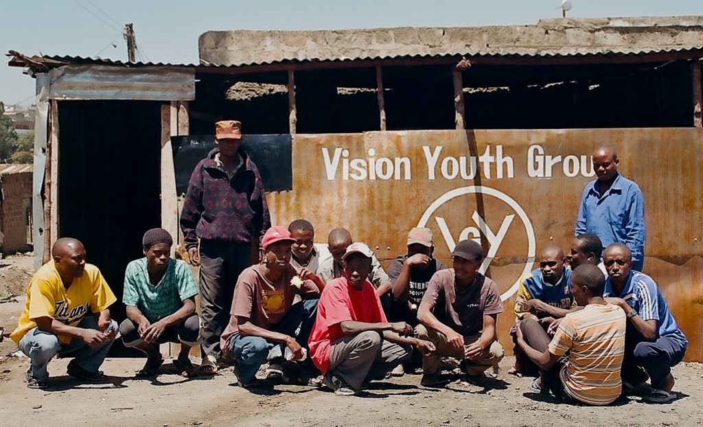
Vision Youth Group
On Friday we digitized over satellite imagery as a part of learning different techniques in mapping. We were hosted by Community Transformers in Mathare No10. I’m particulerly proud of Huruma girls (and one man) who digitized a big chunk of Huruma (Kaimaiko area) and were listening to every advice with their full attention.
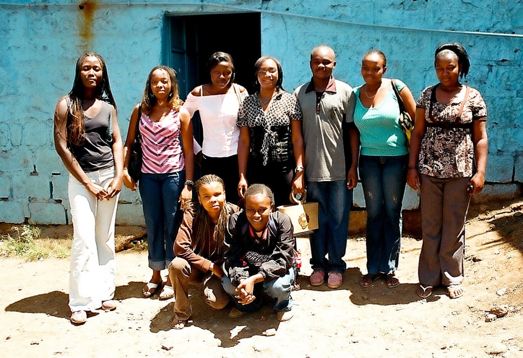
Huruma Girls (and a man)
Video had some technical problems when trying to edit videos in Mathare No1o at Community Transformers on Wednesday and Thursday. But with the passion and help from a videographer Nathaniel Canuel they will make it next week.
And there is exiting news for the Voice of Mathare: We’re getting there!
I should finish by saying: “No I’m not afraid. As long as Mathare folks know that this is their program nothing will happen to me when I’m roaming through the streets with all that equipment” But just in case, they are watching closely, I can feel it!
More of the same on: www.mappingnobigdeal.wordpress.com
“Participatory methodology (PM): A combination of approach and methods through which people do things themselves interactively. What they do may be appraisal, analysis, planning, action, learning, changing, monitoring, evaluation or other activities”
Robert Chambers. Paradigms, Poverty and Adaptive Pluralism. IDS Working Paper 344. July 2010
Map Kibera did not begin as a participatory development project. The initial project was an attempt to introduce open source technology – namely, OpenStreetMap – into a community that had previously not had a publicly accessible map (for all intents and purposes it was “unmappedâ€). Initial mapping of Kibera was done quickly (in 3 weeks) and local leaders, including administration were consulted but not necessarily engaged in the process. Interest from the international community and the innovative nature of the project fueled its expansion and the local community was left behind.  The entire Map Kibera team has been reflecting on these experiences, individually and as a group, over the last couple of months (read Mikel’s reflection here).
In November 2010, Map Kibera became a research subject. Our initial thoughts were that the research would take away from our work because we would need to give a significant amount of time to focus groups and workshops during a busy time of the year. We were however pleasantly surprised – being subjects of the participatory research process was an invaluable learning experience. We were all able to take time to reflect on the work we had done and consider where the strengths and weaknesses lie. The evaluation of the project – recently shared with us by Samuel Musyoki of Plan Kenya (formerly of Institute of Development Studies (IDS) at University of Sussex) and Mark Skipper of Aptivate – is an important read for anybody interested in ICT4D. Our experience in community engagement has evolved since the early days of the project, particularly because of the team we’ve been working with at IDS.
Map Mathare: employing a participatory approach
Map Mathare is a 4 month training programme in Mathare led by the Map Kibera team. Building on the experiences in Kibera, we hoped to improve the process of community engagement and enhance our skills in participatory storytelling. With advice and leadership from staff at Plan Kenya, we embarked on a journey of community participation in mapping and media. By employing an explicitly participatory methodology, we hope to improve community awareness and impact and reach our main target audience – the people of Mathare.
Our first step was to cross the city (not as easy as it sounds with the Nairobi traffic!) and meet with local youth groups in Mathare. Why? To see if the concept of Map Mathare was of interest to them. Without any interest from the community, we wouldn’t and couldn’t move forward. We had an inclination that there would be support for the concept because we had received a number of invitations to visit Mathare and perhaps start some work there. COOPI, Rebel Film board and Community Cleaning Services all extended invitations separately and we met with their members, who were all excited about the work. We also met with Onserio, the District Officer of Mathare. He was also enthusiastic about the project and began brainstorming ways in which his office could use the information. We continually received calls from Mathare residents who we had met (our first trip there was July) until the day we started on December 1st, 2010. As a colleague recently pointed out, the first important difference between the work in Mathare and Kibera is that Mathare was demand driven, while in Kibera the work was supply driven.
Our second task was to meet and plan the Mathare approach. This was only possible by working closely experienced staff and local leaders, such as Simon Kokoyo – a community development worker with 20 years of experience in Mathare – and Plan Kenya with Community Cleaning Service staff (CCS) – CCS is Plan Kenya’s local partner with experience in facilitating participatory community sanitation work. Of course during this step we secured funding for the project, through a contract with Plan Kenya that is supported DFID (Plan UK) and AusAid (Plan Australia). We also met with the local administration in the area, to ensure support for the mapping process.
Our third step was to formally introduce participatory teaching methods to our Kibera teams. For three days in November, we invaded the NaiLab and were guided through some practical examples and theoretical principles behind inquiry lead learning (ILL). The ILL workshop was facilitated by Mark Skipper from Aptivate. Mark’s challenge, which turns out to be our current challenge in Mathare, was to design a participatory learning experience for 30 young people over 3 days. Of course, his first response was “it can’t be doneâ€. To provide a transformative learning experience, he needed a smaller group. This was not possible we decided – as we had invested countless hours in team-building between the three Map Kibera programmes and were not willing to compromise on who could and couldn’t participate. Mark lived up to the challenge and we thoroughly enjoyed the ILL workshop.  As both a part-time active participant and part-time observer over the three days, I learned that previous workshops we have facilitated have indeed provided hands on participatory and inquiry-led learning experiences. This is mainly because you can’t learn how to use a computer or a GPS or the Ushahidi platform or a flip camera without getting your hands on one and doing it yourself! The workshops and the process were not however participatory in terms of attendance. We’ve had mostly youth attend our sessions and involved in mapping and media work.
Our challenge is thus two-fold
1)     To build participation into the process, encouraging involvement from stakeholders at all levels – women, men, elders, youth, local administration, local elders, you name it!
2)     To facilitate inquiry led learning during the training process – to encourage learning-by-doing and let participants in the training ask and answer their own questions
After the IIL workshop, and many more planning meetings, our fourth step was to get out into the community and discuss the idea with everyone! This was done through a community forum, which was held at St. Teresa’s church on December 1st. The turnout was great! 118 people signed the obligatory “sign-in sheetâ€, while many did not. We estimate the true number to be about 130. Our budget for tea and lunch was shot because there were so many people! The Kibera team presented their work and the Mathare residents discussed the importance of new technology. The group engaged in a “map with your feet” exercise to explore the importance of mapping community resources.
The community forum brought together elders and youth, who identified challenges they are facing including unemployment, tension between local administration and youth, crime, corruption, etc. The general mood of the forum was positive and the attendees were excited to learn from the youth of Kibera.
Map with your feet exercise at Mathare community forum
The week after the community forum we began training. Day 1 – we had 45 attendees.  Maureen (a mapper), Joe (from KNN) and Fred (from Voice of Kibera) presented their programmes and discussed the importance of the work they are doing. Primoz presented the theory and concepts behind geographic data. Day 1 complete.
Day 2 – we started with hands on training in mapping and video with 64 participants – some the same, but some different from Day 1
Day 3 – 59 participants
Day 4 – 59 participants
Day 5 – 14 participants (we only did video training this day so we had a smaller group)
As we move forward, the planning team decided we need to improve the learning experience by making (somewhat smaller) groups. We didn’t (and still don’t) want to turn anyone away, because from the perspective of community participation – the more the merrier! We want to generate and sustain support for this programme from within Mathare. The map needs to be the generated by and for the people of Mathare.
But how do you effectively train 80+ people? We had initially planned and thus budgeted to train 40 people!
The tradeoff to ensure true participation is that perhaps not everyone walks away with as much hands-on experience as we would have liked. We hope however by accepting as many people into the training programme as are interested, the Mathare residents will answer the question “whose map?†with the response “ours!â€
Note: of the 84 participants that came through the training programme in December 2010, the average age was 26.2, with a range of 17 -43 years.
This post is part of a series exploring the ideas and issues that have emerged in our research project with Institute of Development Studies, supported by DFID. All posts from the Map Kibera team, the researchers from IDS, our trainers and colleagues are collected here. As always, we are eager to discuss this work, so we hope to hear your comments.
It’s been three weeks since the New Year when everybody in Kenya (at least who can afford) travels to shambaland. We’ve been doing trainings for the past two weeks – altogether 6 days of mapping and 2 days of video.
The map needed (and still does) more information in order to become a good base map for further thematic mapping which will eventually fill in the remaining empty spots (remember: Rome wasn’t built in a day and the map won’t be either – it’ll take 4 months). Here’s the map by the way.
Our main goal is not the map itself! It’s the empowered youths and community members equipped with knowledge and data about their community. As Simon said for Al Jazeera: â€By knowing what we have we will be in a position to engage our government!†So, in order to better control and supervise the masses of the would-be mappers and reporters from Mathare and our trainers-trainees from Kibera, we divided Mathare into 3 parts. West is villages 1, 2, 3A, 3B, Kosovo and 4B, Central is Mathare No 10, 3C, Thayu, Mabatini, Mashimoni and Mathare 4A, and East is Huruma with all sub entities, New Mathare, Kiamaiko and Mathare North. Yea, it’s a big place!

Trainings
The next thing we did was listen to the ever-present, ever-wise voice of the community – Simon Kokoyo (who, in order to amplify the community’s voices, started a blog which is written by Mathare residents called www.matharevalley.wordpress.com) – who said we should rotate or move our venues all over Mathare in order to get the community’s support and make it easier for people to walk to the trainings.
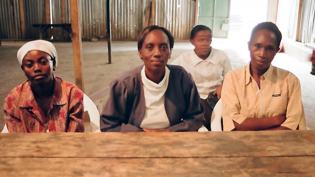
Community Members
The second week of trainings we held mapping trainings at Mathare Environmental Conservation Youth Group/Staken at Mlango Kubwa in village 1 which is run by another well known and respected community member Kaka and at Community Transformers. Video trainings were held one day at Community Transformers and one day out in the field.
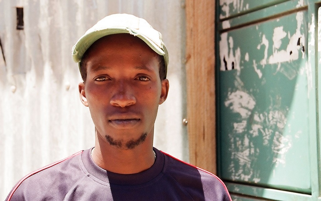
Kaka
To help plan the video trainings we invited two established people, both well known in Mathare: Videographer Nathaniel Canuel and a reporter Wairimu Gitau. They’ve structured the trainings in a way to maximize the effect and tell the stories relevant to Mathare. They’ve divided members into 4 teams and talked about the ideas for the videos to be made. They’ve selected 4 ideas which could be done in a day of shooting and they’ve come up with:
– Lack of toilets
– Road accidents or bad road conditions
– Lack of playgrounds for children
– Broken sewage lines
Next week (24. Jan – 30.Jan) they will talk about which footage was good and which was bad and the folks will learn how to edit the data selected. Can’t wait!
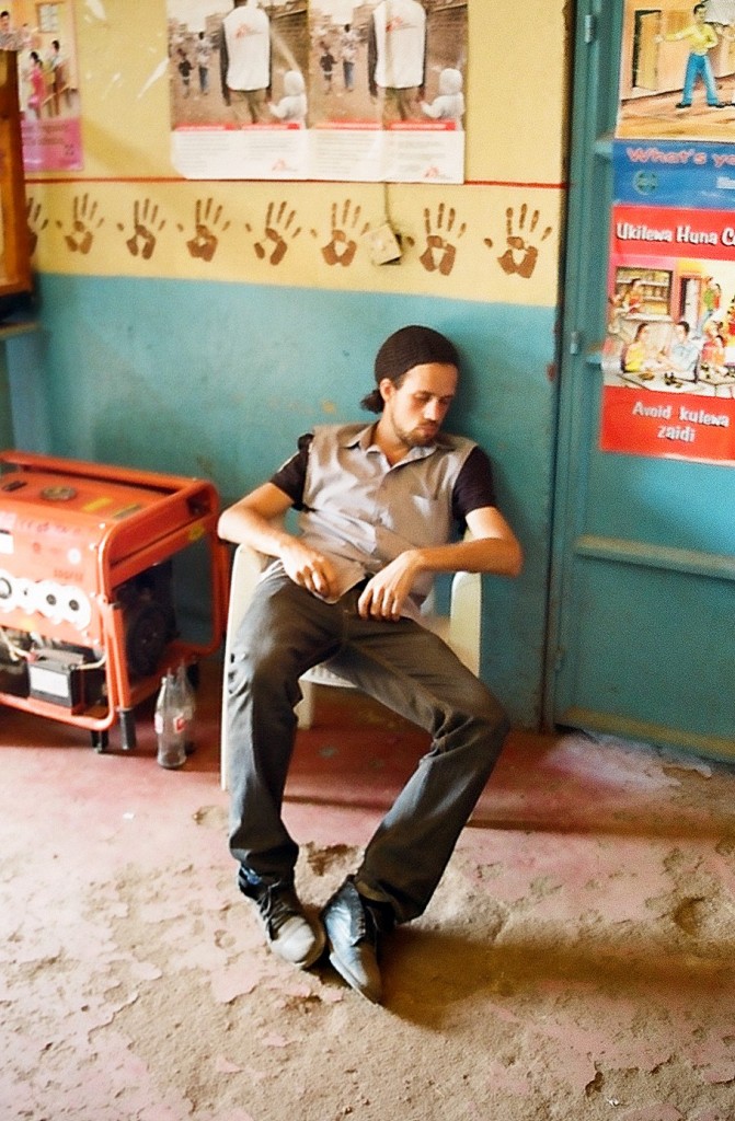
Nathaniel taking a nap exhausted after the whole day of video footage collection
Our third program Voice of Mathare is still under construction (web stuff).
Exciting times in Mathare! There’ll be a storm of activity in Kibera soon, so stay tuned!


