One of the first questions an astute observer inevitably asks of the Map Kibera team is “how do the residents of Kibera access the map if it’s online?†The answer is that most people don’t have access to the internet, and thus don’t have access to the map of Kibera. This is why we’re aiming to improve our community outreach and engage people with the map offline in Kibera.
In Mathare, we’re working hard to ensure community engagement in the mapping process from the outset. We will also make sure the maps and map data are accessible on and offline and that Mathare residents drive the process.
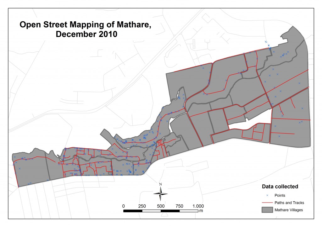
Last Wednesday we held our second community forum. The purpose of this particular community forum was to present the products of the mapping and media training back to the participants and to other important stakeholders. Â The base map of Mathare already has 750 points, Â 41.3 kms of road, 24 village boundaries and 138 buildings (read more about the base map here).
The forum was also an opportunity to discuss the next steps for the mapping work – we are moving on to thematic mapping. Prior to the forum, the training programme planning team (consisting of representatives of Map Kibera, Plan Kenya, Community Cleaning Services, and Mathare residents)  discussed the themes that were most important to us. We settled on water and sanitation, health and education. We agreed that despite the importance of these themes, it was most important to ask the programme participants and other community representatives to identify the themes that resonated with them in their daily lives. What did they want to map?
We printed out maps of the data collected thus far on large sheets and took with us copies of the 4 videos the Mathare videographers had produced.
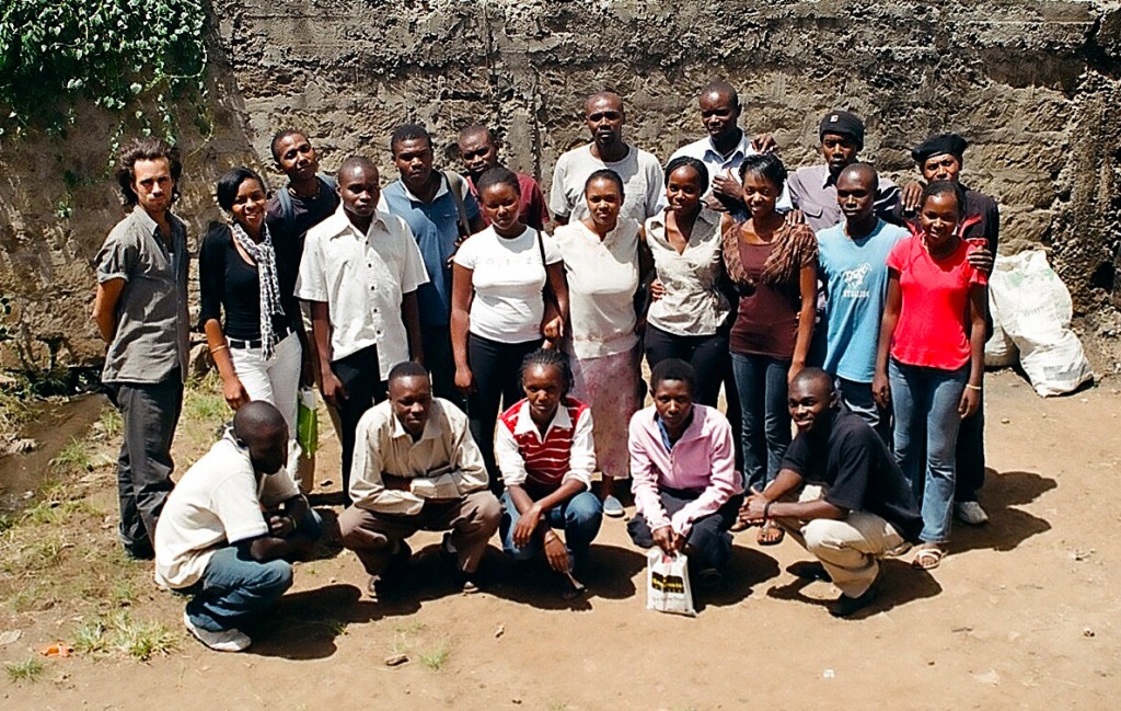
The forum began shortly after 10am on Wednesday February 9th, with about 160 people in attendance. Simon Kokoyo (the Map Mathare project coordinator) led introductions, asking everyone to stand and state their name and village. It was clear that all villages (and the five wards) in Mathare were represented. There were many familiar faces from the trainings, but also new faces. The Community Cleaning Services (CCS) facilitators and representatives from Dignitas Project and Roots Mathare were there, as well as a public health officer, community health workers, the local area chief and elders. Community Transformers – our host for the training programmes – attended the forum, along with the majority of the training participants.
Simon asked for feedback from mappers  – “What did you learn?†There was mention of learning about technical aspects of mapping: the use of global positioning system (GPS, often used interchangeably with GPRS, despite our attempts to correct this), collecting points, and uploading information. More significantly, participants of the mapping programme discussed how mapping  has helped them identify resources within their villages. One participant mentioned that he realized that he didn’t know his village as well as he thought and there are a lot of resources that are not exploited in Mathare.
The video team talked about what they had learned, including taking shots and editing video. One participant mentioned the use of video to highlight problems and social issues – such as the on-going water shortages in the area.
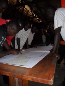
After the feedback session, Simon divided the room in half – half of the room went back to look at the 2 maps taped on the wall and half watched the videos. We had other maps on the table that some attendees pored over and discussed.
We had planned to watch the videos together at the beginning of the forum but due to logistical constraints (the extension cable was too short, there were only two power outlets in the whole room and the PA system was using all the outlets) we had to resort to showing the videos in small groups around two laptops.
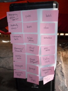
After everybody had had time to look at the maps and watch the videos, Rose from CCS led look us all through a review – “What did we map?†This feedback session took about 30 minutes – we had answers like clinics, choo (toilet), schools, mpesa points, slaughter house, bridge, matatu stage, etc.
Rose then asked everyone to group these features based on their relationship to one another. Eight “themes†emerged – transport, recreation, businesses, health, water and sanitation, security and institutions, which was further broken into education and institutions. The theme “institutions†also contained churches and there was some debate as to whether churches should fall under education because many schools are run out of church buildings.
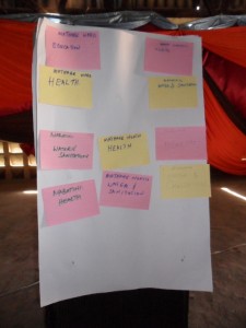
After the eight themes were determined, the attendees broke into teams based the five wards in Mathare (Mathare, Mabatini, Mathare North, Huruma, Kiamaiko). Each ward picked the top two themes they wanted to map – based on the importance of the theme in their village. Four of the five wards all picked water and sanitation and health as the top two. The 5th ward (Mathare) picked education and health. So, the themes Mathare residents will map in detail in the coming months are water and sanitation – which really could and should be 2 themes because as we learned in Kibera and from working with CCS, this is a very complicated theme – and health.
It is encouraging and exciting that the two themes (health and water and sanitation) were also themes that the planning committee identified as important. We’re on the right track!
We’ve learned that consensus building is of the utmost importance. Like the first community forum, this second meeting again brought together people of all ages, representing different interest groups. The forum facilitated dialogue among residents of all Mathare’s villages.
This map is for Mathare and the residents of the area need to drive it’s design and development. If they own the process, we hope that they will use the map in future planning and advocacy work. It’s with great pleasure that we can say the excitement and enthusiasm for the Map Mathare training programme is still alive and is in fact still growing.
