by: Zack Muindre November 9th, 2018 comments:
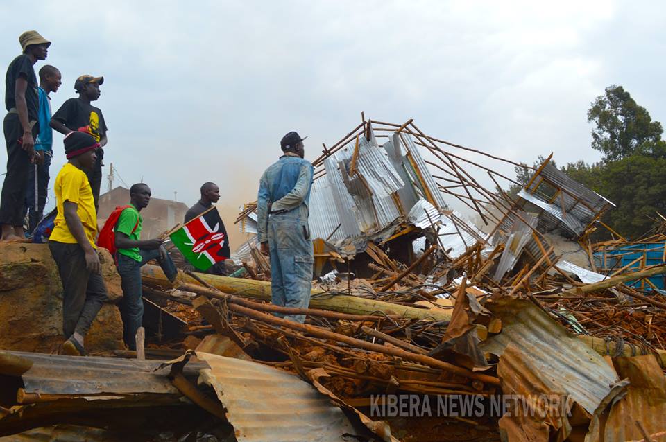
2018 is a year that most of Kibera residents would really like to forget. In the last 6 months, the residents of Kibera have been waking up to the sounds of bulldozers in their neighbourhood- not for purposes of evading traffic along Lang’ata road or Ngong Road. This time they had come with one purpose, to bring down structures which most of them had called home. To some, it was their business which ensured that they had something on the table at the end of the day. And to others these structures served as schools where their children went to learn and get the necessary knowledge that would prepare them for the market place and change their lives forever.
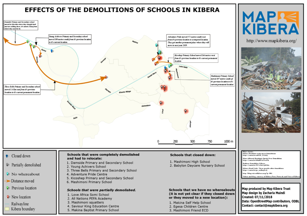
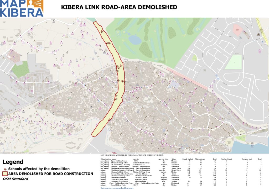
A map designed by Zack Wambua showing the effects of the demolitions of schools in Kibera (click image to expand).
The demolitions in Kibera affected 4 schools that were located near the railway line around 42 area and 10 more schools were affected when structures were demolished to pave way for the construction of Kibera Link road (the road meant to link Ngong road and Lang’ata road to ease traffic on Ngong road).
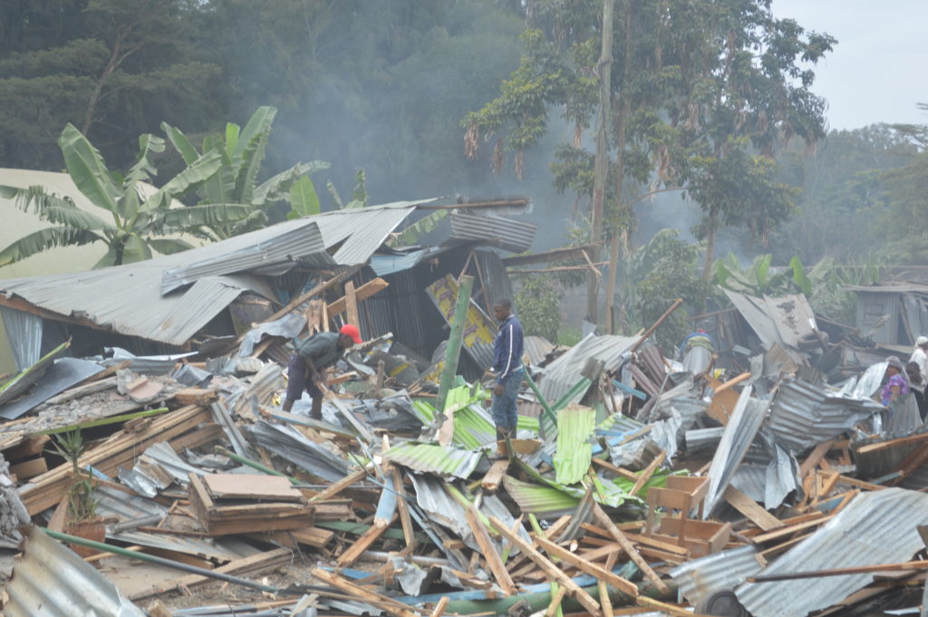
Demolition of structures that are along the railway line at 42
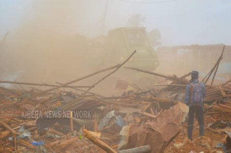
A bulldozer brings down structures around the DC’s place.
After all these incidents Map Kibera team went back to the field to track the schools that were affected and update their current location on the Open Schools Kenya website. On our way, we stopped at Babylon Day Care to talk to the school head (who also happens to own the school) to find out if she knows where some of the demolished schools might have moved to. In between our conversation, we learnt that one of her other schools had also been demolished. Her face was filled with grief and sadness as she explained to us how she was forced to take some of her students to the nearest schools because she had nowhere to take them. We asked if she intends to reopen her school again and she told us she doesn’t see the need to and if she gets that chance again she will only do that in her rural place. After our short talk she shared with us the contacts of another school called Damside Preparatory that was affected and told us that the principal of that school would be in a position to tell us where the other schools relocated to.

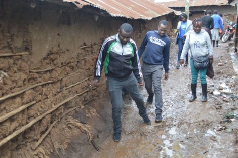
In some area we had find a way through the muddy footpaths to find the schools
I quickly saved the number on my phone and proceeded to where we had been directed. When we got there, we were met with a vast empty land and the remains of what used to be people’s homes and schools. I called the school head and after a brief introduction he told me to go to where the school used to be as he was already there. We went through the rubble and after few miles we saw a group of people standing together. When we got to where they were we quickly introduced ourselves. The school head introduced the team that he was with, which comprised of class 8 candidates and two parents. The school head reminded us that the place where we were standing on is where their school used to stand and they were meeting there to finalize on their preparations for the forthcoming national exams. We were curious to find out where the students will sit for their exams now that the school had been demolished.
“The government offered space for the students in one of the nearby public school and so that is where they will do their exams,” said the school head.
“So what is next for the school? Have you found a place to move to?” we asked.
“Yes we got a place, we bought land somewhere close to Kiserian and that is where we have moved to,” said the school head. He went on to say, “So far we have been able to construct 2 classrooms and a dormitory. The plan is to have the school operate as a boarding school.”
“But that’s too far from Kibera, what happens to your students who live in Kibera?”
“I agree that’s far and the move has proved to be a challenge to some of our students since majority of them were needy and so they cannot afford all the requirements to be in a boarding school. We would have loved to move closer but where in Kibera can we move to? We all know how hard it is to get land let alone to get a title deed.”
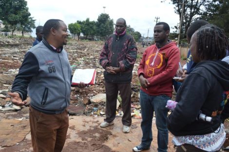
The School Head of Damside narrating their ordeal
The school head went ahead to recount how they had incurred a lot of losses as a result of the demolition. He had just acquired the code to make his school an exam centre, a process that had cost him 100,000 KSH. In addition, he had just finished building a laboratory earlier this year that also cost him a large sum of money.
Afterwards, the school head agreed to an impromptu interview with members of our media team, Kibera News Network, who had accompanied us (check out their video here!). He also asked us to interview one of the parents and a student so that they can share their side of the story.
The school head later told us where the other schools moved to. One moved to a nearby SDA church, another pitched tent in a nearby health dispensary and the other one moved somewhere along Karanja road.
After saying goodbye, we left to find those schools and pick the coordinates of their new location. On our way we couldn’t help but think of what some schools have had to endure as a result of the demolitions. Some have been left counting

Sam picking coordinates of where one of the schools moved to.
losses, some have been forced to shut down. Others have had to partition some of the rooms to accommodate the number of students. Parents had to go through the hustle of looking for a new school and the most affected group is the students that have to walk a long distance to their new school and at the same time adapt to the new environment. I can’t imagine what could be going through the minds of class 8 and form 4 candidates. How are they supposed to compete with students from other schools considering what they have been through? While other students were in classes reading, students from the affected schools were busy trying to salvage what they could from the rubbles of what used to be their classroom. While other students are reading their books, students from these schools lost all their books during the demolition. The few books that they could salvage would have to be shared amongst themselves which means that they don’t get a chance to carry the books home with them to read.
We will continue to follow up with the schools, and update their information and locations on Open Schools Kenya.
by: Joshua Ogure July 28th, 2018 comments:
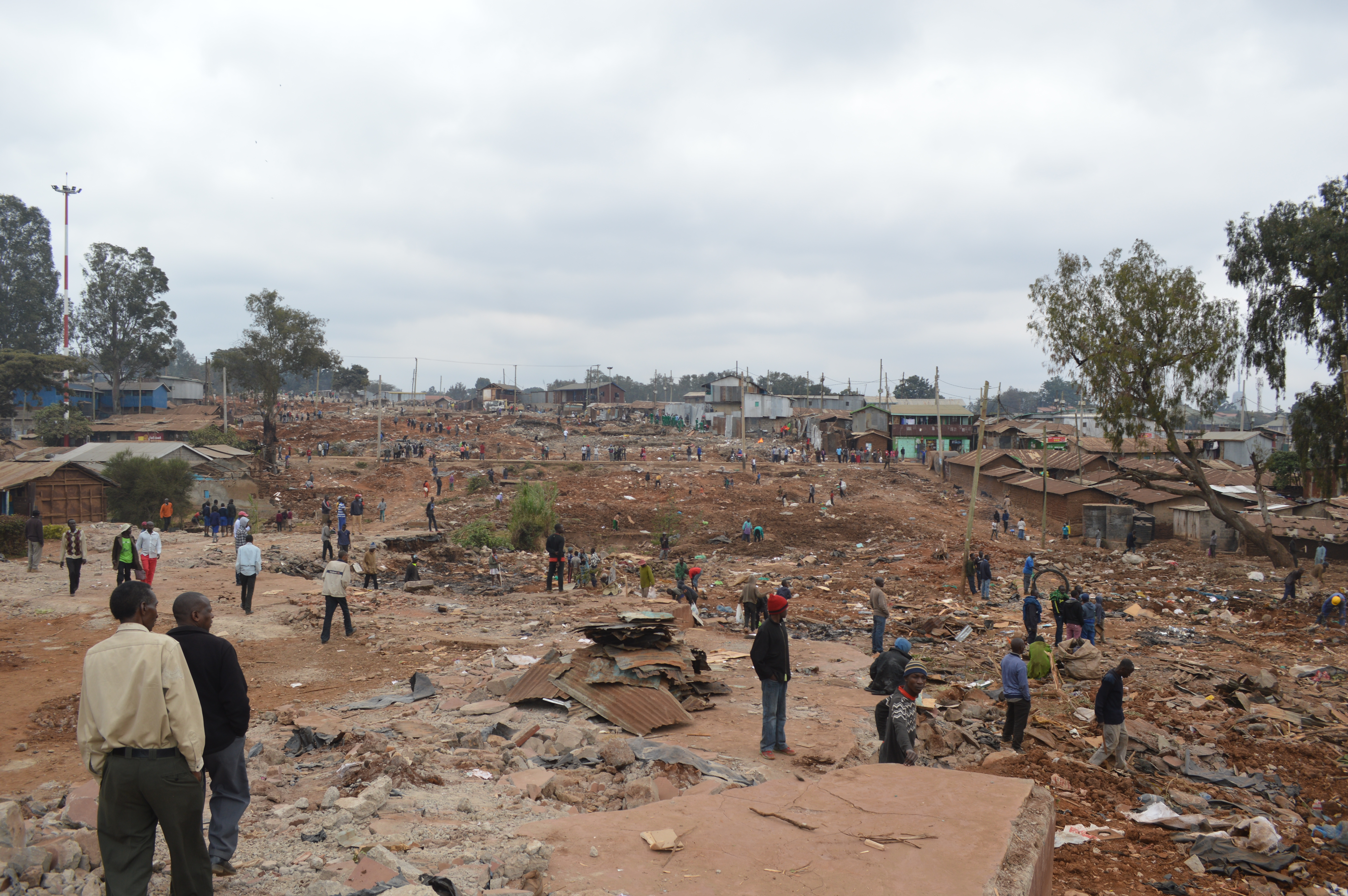
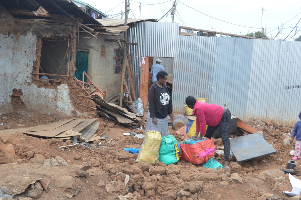
The morning of Monday July 23, residents woke up to a shock of heavy police presence and bulldozer ready to bring down their homes. The demolition started by 7am as the residents watch in disbelief. It was at the same time a race against time to be able to rescue whatever property they could from their houses. Children ran around helter skelter, women cried helplessly and everyone carried away whatever they considered important to them.
The road will go from Yaya Center to join Langata road, through Lindi into Kibera South Health Center from DC’s area. Around 30,000 families have been affected by the demolition. The road was identified in 2014 and is meant to ease traffic within Nairobi city.
Kibera residents have been living with a lot of uncertainty in the recent past. Not so long ago we witnessed the Kenya Railway decanting sites being demolished, leaving around 1000 residents homeless, some of whom even had housing allocation numbers and the key without a house. Just before that there was a major demolition all round Moi girls where a form two student girl was reported to have been raped by unknown person. Now, a huge road is cutting Kibera slum into two.
The residents had been given a notice to vacate the area, however, at the time of the demolition there was already a postponement order. There had been three different maps showing different routes that the road would pass. How were the residents supposed to know which road map would eventually be used? This led to a lot of push and pull between Kibera activists, civil societies and the government. Questioning who diverted the road three times and why was not futile. Several meetings were held between the affected persons, Kenya Urban Roads Authority, Kenya National Human Rights Commission, and the National Lands Commission trying to find an amicable solution to the issue and the best way the demolition would be carried out humanly. The two weeks’ notice was then extended indefinitely awaiting an enumeration and the development of a Relocation Action Plan, something that might have relieved the affected persons for a while. There was also a case in court awaiting ruling on the same issue. However, all this was disregarded that morning of July 23rd.
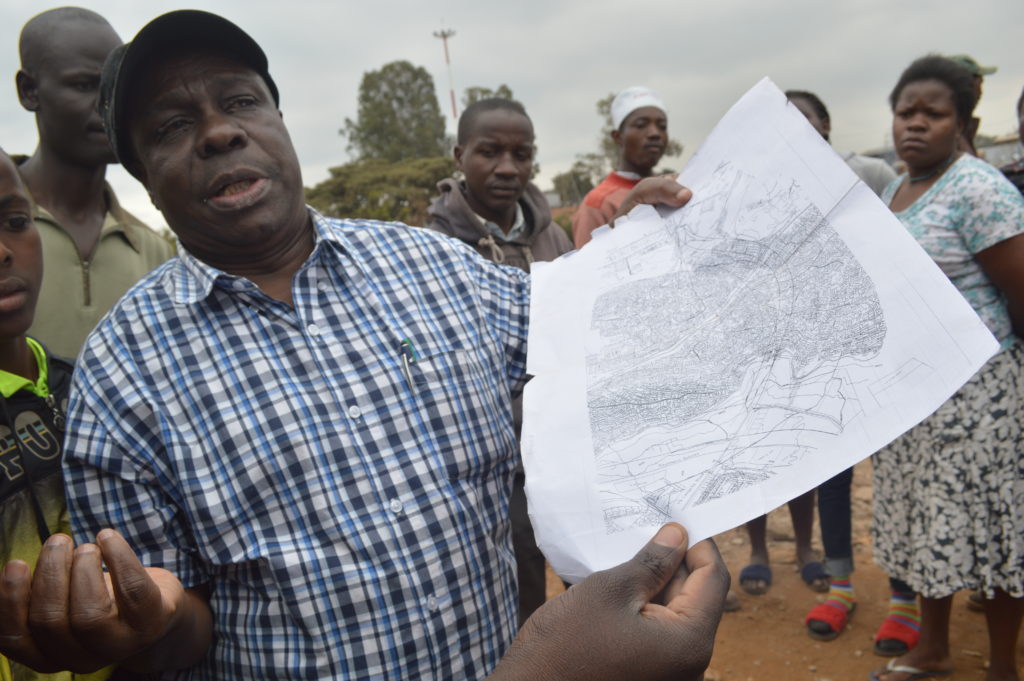
The 10 acres road has also cost the Kibera people more than 10 schools, as well as churches and community based organizations. The schools as mapped by Map Kibera includes Egesa School, Makina Self Help Group, Makina Baptist, PEFA, Good News, New Horizon, Love Africa, Mashimoni Primary, Mashimoni Secondary, Mashimoni Squaters, Saviour Kings
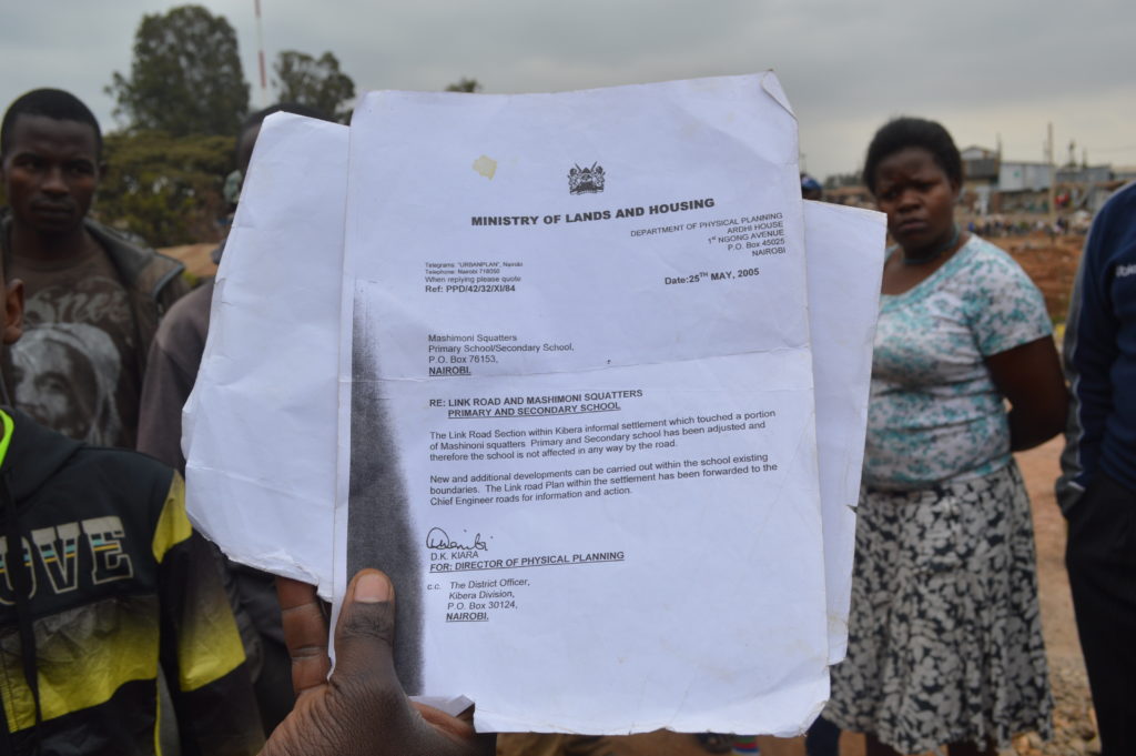
It’s at such times that many residents wondered whether they really belong to the country Kenya.
“We are not against the road passing, but can’t it be done with some dignity?” says the Founder of Egesa school. The schools only had one week to take their end term exams. The students will therefore not sit the exam. “It’s very unfortunate for the children who will miss their end term exam simply because of some greed, selfish and in human act.”
Don’t forget that the road has also robbed off Kibera their only social playground near DC’s area. How does it feel when a road has robbed you off your home, your livelihood, your church, your children’s school, your only social playground? People have also lost jobs. Only a few people would be in a position to find themselves a new place or even afford to travel back to their upcountry homes.
“This is the greatest betrayal I have ever seen from the government, see how people are calm no one is even reacting or protesting because they made us to calm the people down, promising to tackle the issue smoothly,” lamented Ben Ooko, the founder for Amani Kibera, a Community Resource Center that also suffered demolition. “I got a call very early in the morning that the police were heading here with a bulldozer, and I just rushed here to see. We really didn’t expect this because we had kind of reached an agreement with KURA in the presence of KNHRC, and so we were waiting for their guidance.” That morning Ben had posted on his Facebook, “Today is my birthday, and I get a gift of demolition.”
Some people believed that this is a scheme by the government to try and finish Kibera in a bid to weaken the opposition, but where is Raila the former Prime Minister? Why is he so quiet on this? Kibra MP Hon Ken Okoth, who is currently out of the country, has in the recent past made a lot of noise on social media to have his people handled with some dignity even as they move from road reserve. But neither him nor Makina MCA Hon. Magembe could lobby to stop the demolition. Amnesty International accused the government for not following the agreement to relocate the persons affected, terming it a violation of Human Rights according to the International Human rights obligation. Is there such a thing as Human Rights and Constitutions to the people of Kibera? Article 40 of the Kenyan Constitution provides that those who occupy land without title deeds may be compensated in a good faith. What next? Who next? Where else? When next? How else? These are some of the questions lingering in the heads of Kibera residents.
Till when will Kibera people live with all these fears?
By Joshua Ogure
by: Zack Muindre January 11th, 2018 comments:
As the year 2018 has just began, everyone is busy writing resolutions, some reviewing what worked last year and what they need to change while others are writing new resolutions for the year. We at Map Kibera also took time to reflect on how the year 2017 was for us in terms of the work that we were able to do.
Security mapping/election monitoring
Una Hakika Project
The year began on a good note with the team in Map Kibera conducting a baseline survey for a project that they would be implementing in Kibera in partnership with the Sentinel Project. The project was dubbed Una Hakika? (Are you sure?), and the aim of the project was to assess and moderate the spread of rumours before, during and after the August election.

Una Hakika launch event at Undugu Ground in Kibera
With the August election drawing near, Map Kibera with the help of 3 students from University of Nairobi and JKUAT who were on internship through the Youth Mappers programme conducted a mapping exercise with the help of local community ambassadors drawn from the Una Hakika project.
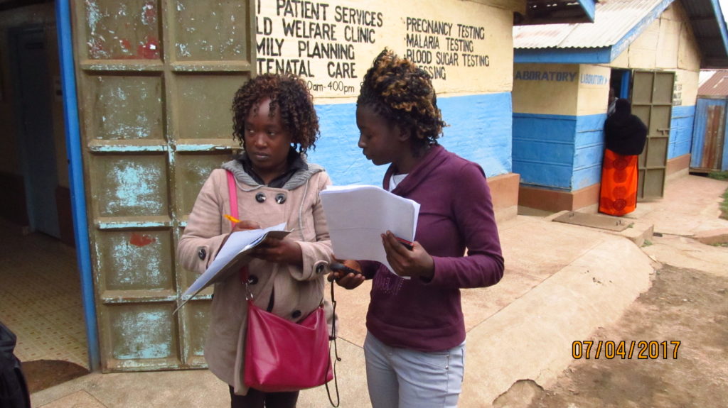
Lucy Fondo (on the left) and Phylister Mutinda collecting data in the field
This was to update the security map that was last updated during the 2013 elections. The printed copies of the maps were distributed to the local administrative officials as well as to NGOs that work in Kibera on peace initiatives.
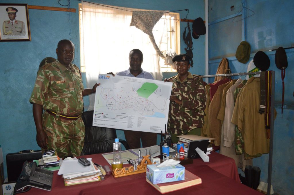
Joshua Ogure issuing a copy of the security map to Adminstration Police commandant
The other copies of the maps were distributed to community members. Read more here. The updated security map was also painted on the wall at a strategic point in Kibera where the community members and visitors would interact with it.
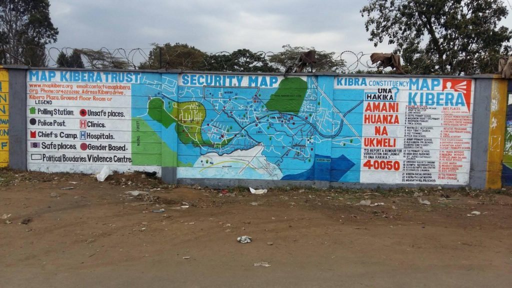
Updated Security map on the wall
During the August 8th election Map Kibera through the Una Hakika project also set up teams on various polling stations to report on the events as they were occurring. This was done through video coverage by the Kibera News Network team. The team was also supposed to report any issues by sending sms to the Una Hakika’s short code 40050.
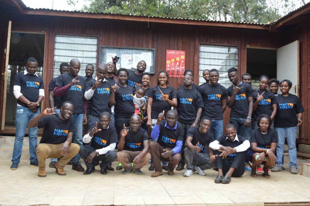
Citizen reporters trained for the elections
Video Coverage of Elections by KNN
The KNN team produced more than 50 videos for both August 8 elections and the repeat October 26 elections. At least one video went “viral” with more than 13,000 views: Kibera Supports Supreme Court Ruling.

A screenshot of the videos produced by KNN during the election period
Repeat election
On 1st of October 2017 the Supreme Court Of Kenya nullified the August 8th Presidential election. The electoral body of Kenya was thereby asked to organize a fresh presidential election. This meant that our work on election monitoring wasn’t yet finished. So we organized and re-strategized to prepare for the fresh election. The period before the new set date for election saw a lot of demonstrations from the opposition team demanding changes on the electoral body before conducting another election. Kibera News Network documented some of these events, and even did interviews with some of the victims of police brutality after violence erupted immediately after Uhuru Kenyatta was declared the winner of the August 8th election. The IEBC set a new date for the repeat election to be 26th October. We monitored these elections afresh just as we did earlier.
Research
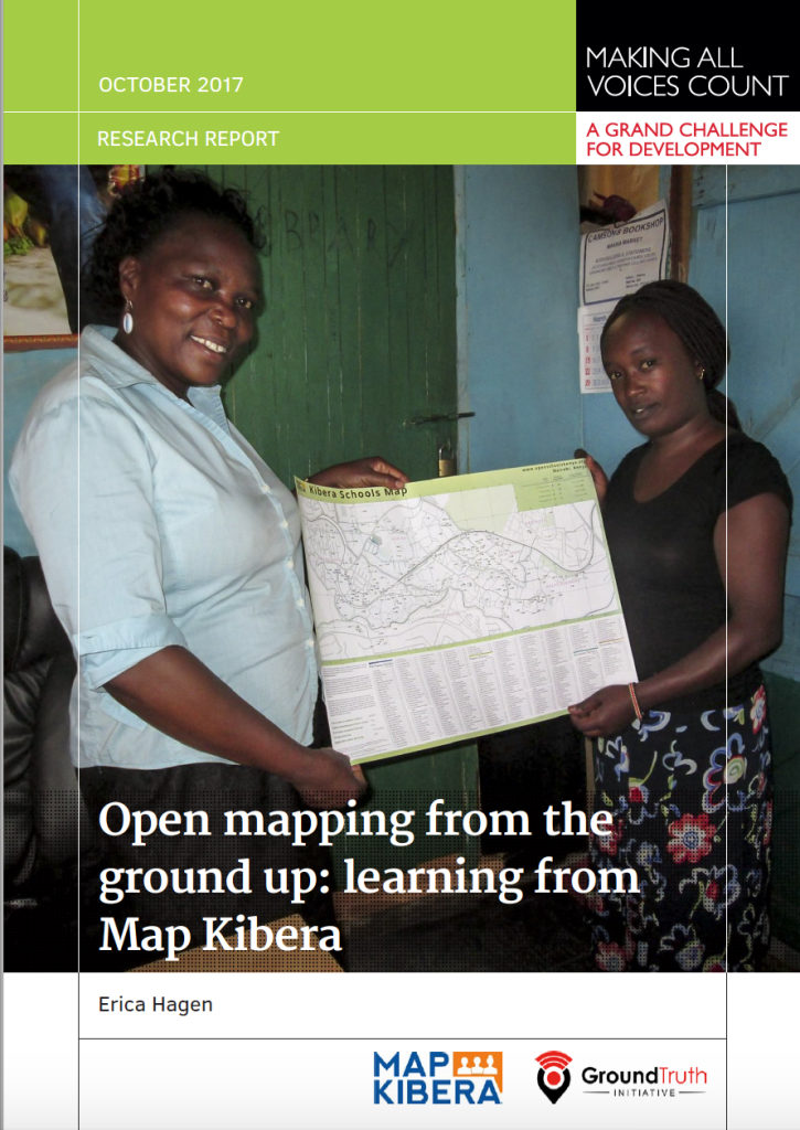 In the same year Erica Hagen, one of the co-founders of Map Kibera, was funded by Making All Voices Count to conduct a research on the impact of the work of Map Kibera in the local community and how the maps are being used by various local organizations, community based organizations, government offices and the community members. Key outcomes were that local officials had used our education maps to reach out to informal schools, build networks and extend resources to these schools. NGOs had also used other maps by Map Kibera to locate resources such as water and sanitation facilities. The research report can be read here.
Sharing, Participating, Collaborating
The year 2017 also saw Map Kibera being recognized and invited to attend various international and national events to share about their work. Some of the meetings were: the High-Level Meeting on Data for Development in Africa held by the Kenya Government and Global Partnership for Sustainable Development Data (GPSDD); Buntwani 2017 organized by Open Institute, Making All Voices Count, Dlad and Data Zetu in Dar es salaam; the Data Pop course at UN Headquarters in Nairobi, and a radio interview at IQRA FM.

Joshua doing demonstration about Map Kibera and the open schools project at the High level meeting.
 ICT4D
For the second consecutive year Map Kibera has been invited to speak at the ICT4D conference. This year’s conference was held in Hyderabad, India and the theme for the conference was from innovation to impact. Zack Wambua represented the organization at the conference where he shared the impact of the Open Schools Kenya project. Zack also had an opportunity to visit one of the local organization Hyderabad Urban Lab to learn more about the work that they are doing around community participatory mapping in Hyderabad.

Zack Wambua at the ICT4D conference.
 State of the Map (SOTM) AFRICA
This was the first ever SOTM event to be held in Africa, and Map Kibera being one of the oldest users of OpenStreetMap in Africa were invited to share about their work on community mapping, a model that has been borrowed by many groups and organizations that use OSM. Joshua Ogure the project manager of Map Kibera travelled to Kampala, Uganda to represent the organization at the event. Read more here  http://www.mapkibera.org/blog/2017/07/21/my-experience-at-the-first-state-of-the-map-africa/
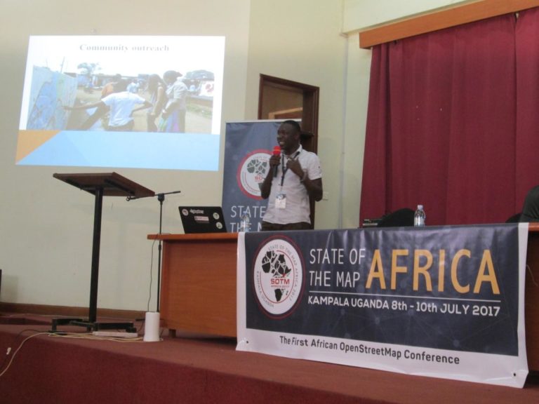
Joshua Presenting Map Kibera at SOTM Africa Kampala
SOTM Tanzania
After the successful SOTM Africa event, OSM teams in Tanzania led by Crowd2Map and Ramani Huria organized SOTM Tanzania. the event took place in Dar Es Salaam. Map Kibera was again called to assist with the planing of the event and also to share about their work during the conference. Zack Wambua travelled to Dar to represent the organization at the conference.

A group photo of all the attendees at SOTM Tanzania
Open Schools Kenya
In 2017Â Map Kibera kept up with changes to the Open Schools Kenya data. We along with our interns checked if the schools were still in the same location and if they had moved, we collected coordinates of their new location and updated the details on the site. We were also able to update school populations (for both teachers and students), changes in school management as well as any other co-curriculum activities that are offered in the schools. This was followed by an update to the website, where we added a search by location filter which enables you to view the schools’ data in both Kibera and Mathare, the two locations that we have rolled out the OSK work. Look for more changes and additional locations in OSK in 2018!
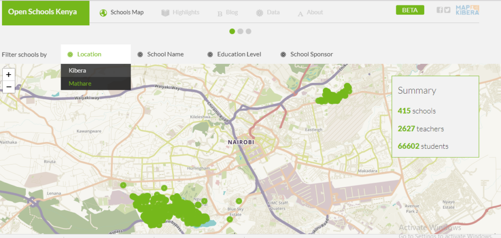
A screenshot of the updated Open Schools Kenya website with the new search by location feature


