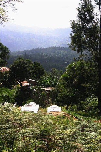
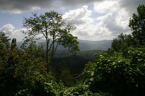
The small village of Wongonyi is located in the Taita hills not far from the coast, nestled among lush hilltops with views over the massive Tsavo game parks. Mikel and I had the good fortune to spend a recent escape-from-Nairobi weekend there. Our friend Primoz who sent us was a minor celebrity up in these parts for having actually walked and mapped the whole village, which is spread over several very steep hilltops.
The entire constituency of Mwatate, in fact, has been on our radar for a while; we visited local authorities with SODNET last year, and they were very interested in getting community feedback through mapping or other technology. We made plans to come up and do some training. But Wongonyi is literally off the grid. To what extent can technology make a difference, or even make sense, to the small-scale farmers living up here? Places like this always inspire me, and challenge me to question everything we consider to be “development.”
Just around the corner, but a million miles away
To get to Wongonyi, you must brave a matatu ride from the town of Voi up a steep, deeply rutted dirt road, for 250 shillings ($3 in a dollar or two per day economy), or for twice that amount you might get a seat in the four-wheel-drive truck. This is a road built where nature never intended. Following partly along the course of a dried riverbed, it hugs the mountainside improbably and forces a speed of about 2km/hr. At 7:30 each morning, the matatu pitches and heaves back down carrying some 20 people in seats meant for 14, along with several gallons of fresh milk in empty plastic vegetable oil containers to sell in Voi. Mama Ruth, our adopted mom on the mountain, tells us that improvements have been made: now we have 2 matatus and the truck, when we used to have just one matatu. She says it as though she owns them, and in a way, the vehicles do belong to the whole town – even she, who could afford a car, wouldn’t bring it up the mountain, where it might melt into the earth during a hard rain. It simply doesn’t make sense to own a vehicle that isn’t being used constantly and by everyone.
The road has actually been paved in concrete in some particularly unwieldy passages, rendering it passable on most days. Progress, we think. This must help the residents. Not really – matatu prices have not decreased for villagers, and the only change they’ve seen is that big logging trucks can now make it up the paths into pristine forest, and bring the goods back down. In fact, the local chief started to tell people not to cut their trees because a place like Wongonyi depends heavily on sustaining a delicate environmental balance. The shangas, or small household farms, are built on terraced mountainsides next to trees that hold the slippery earth in place. Most of the trees have been planted, after an initial shaving of the hillsides many years ago. A virgin forest – more of a jungle – tops the mountain, also preserved in order to prevent devastating erosion and to protect the watershed. When milk prices fall for these subsistence farmers, they are understandably tempted to cut the trees on their property for some 50 shillings (though the middlemen can make several times that in profit) and the chief must intervene.
Village to Village
We happened to be in Wongonyi at the same time as a family of four Canadians, the Woods. Hailing from a small town in northern Ontario, they had turned fundraising for Wongonyi into a family passion and this time brought 600 kilos of donated items (baby clothes, dress patterns, solar lamps). We watched them unveil a sunflower seed-press for a women’s group, bought from Kickstart in Nairobi. The Woods had also begun to construct a playground at the elementary school, donated baby clothes at the clinic, brought sewing patterns and fabric for a seamstress training project, and were paying scholarships for a few girls to finish high school and college. We had several interesting discussions with them as they debated what would make the most impact and not go to waste, and tried to convince people they were just small-town average folk like themselves. Ronnie Mdawida, a local resident, had been their exchange student in Canada inspiring the founding of their Ronnie Fund. Ronnie is also the reason we are there in Wongonyi thinking about how we can possibly lend our own skills. After founding Kosmos Solutions with an American friend, Ronnie and his wife Sarah have been working hard to improve the village. Challenges here abound: alcoholism and absentee drunkard fathers are common, girls go to school only until their parents decide they’re much more useful collecting firewood and managing the household – usually before the age of 12. There is no electricity, minimal running water, and few medicines at the clinic. The death of a parent can leave 8 children fending for themselves off the food raised by farming on steep terraces, and funerals are frequent due to lack of medical care. HIV has made its way up from the towns. But there is an abundance of less tangible goods: extended family usually lives just down the path, and neighbors support each other in times of need. The stars at night come out suddenly in bright abundance, just after the pink sunset fades over the plains below. Food is cooked in large batches and shared with friends and family. Folks will walk half the day to attend the funeral of someone they were barely acquainted with, bringing small coins or food. They are buried in their own backyards. And the land is incredibly fertile. Taita was largely spared from the drought that recently plagued much of Kenya. Several springs and rivers run down the mountain and provide natural irrigation. From my perspective, too, arriving in Wongonyi was like coming home to a family I never knew I had. Everyone we passed said a bright hello (or, rather, habari yako) and wanted to know what we were doing, maybe have a chat. I also felt the urge to say hello and learn about every person, releasing my cautious and guarded Nairobi attitude.
Mapping and Media in Mwatate
So – what is it we’re planning in this hamlet? Primoz, as mentioned, has already mapped the village. Our partners at SODNET want to extend that to the whole constituency. We want to do some training as we’ve done in Nairobi, with young people who want to map their own villages, and think of other ways that the rural community can hold information locally for policy impact and self-advocacy. With a receptive MP this can be very effective; he complained to us that he simply doesn’t have enough basic facts on the area’s needs. Collecting, sharing, talking, and thinking about community needs might mean starting mobile phone radio or storytelling with the local girls’ club. I think it’s really important not to plan too much from the outside (Nairobi), but to come with ideas and allow the process to develop organically. Certainly, that’s what has worked in Kibera. I’m ready for this process to be much slower than it’s been in Nairobi. Everything is slower in Wongonyi. I certainly don’t mind. Walking and then talking face-to-face is still the primary communication method, although mobile towers allow for decent coverage. Everything is done on a personal level: small projects come and go, each meant to provide income: butterfly farming, biogas collection, etc. What might happen if some of the girls in the girls’ club had the experience of creating short videos or audio recordings about their lives, or about anything at all. Would it be a confidence-builder, could they even participate in the village planning process this way with pride in their special knowledge of a technology that others don’t know? That’s been a boost to our current group, made them feel smart and proud. Or is that simply going too far: after all, the girls in the club lead what we’re told is a tough life of household work, farming, and school, and leaving their chores for even one hour a week can be a tough sell to parents.
Are we the teachers, or the students?
Mikel and I left Wongonyi feeling inspired yet challenged: him pondering the difficulties of life so cut off from anything outside or “modern”, me bemoaning the fact that the world we usually inhabit has lost the communal aspect of life and regard for nature that is simply required for survival in such an environment. Each other human is worthy of time and respect, and is valued if only because of being few humans so dependent on each other. But aren’t we all, in fact, dependent in this way – only we’re able to pretend otherwise? Aren’t we also at nature’s mercy for survival, only we offhandedly destroy it daily? It might be romanticism, but seeing only the poverty and dire challenges confronting these villages is also nearsighted, though that is the typical language found (abject poverty, desperation, disease, hunger). It’s the same language used to characterize Kibera, the image that can hurt more than help. Blanket characterization of any way of life as either piteous or righteous is far too facile. I only hope that our contributions to Wongonyi and Mwatate can help them to plan and advocate for what they want, and as always, to know that their knowledge and views are important and should be shared. If we ever hope to find balance on this planet, it’s their stories even more than ours that needs to be heard. Whose reality counts? Can we offer something useful – whether technology or simply the knowledge that they now count, they are visible, they have this map, or these stories, and they can slowly impact the course of life in Mwatate? It is in such small-scale development work where we encounter what I consider to be the central dilemma of the issue at hand. Here we are, from the outside, doing something we think will “help” someone else. How can we ever know what impact we will have? Are the things we bring from our own culture – like technology – a blessing or a curse here? The only way out of the paradox, is to learn, listen, and to bring your humanity. Is there any other way than to offer something you believe in, while honoring the small ingenuities or qualities you encounter in the other? Otherwise, you either continue dependency cycles or simply are seen as somehow better and wiser simply by merit of your apparent power and wealth. Why do we so often hide the fact under a veneer of “professionalism” that we are interested in benefiting too – that all is not perfect in our world, either, and we are there because we want to enjoy ourselves and learn, not from pity. We are equals, merely sharing skills – we happen to have the ear of the powerful, and some tools that might help bridge the gap. What skills can they share in return? I would love to know how to manage a small farm or even kitchen garden. I’m hoping to get my shamba started as soon as someone can teach me.


