The second phase of Water and Sanitation mapping is over and with it the pilot in Mathare, which lasted for 4 months. You can read all about the events and the processes leading up to this point on our previous blog entries. I will call this an intermediary analysis because the work is by no means over, but we’re at a good stopping point to reflect and set the way forward.
Here’s the data we collected regarding toilets, water points and open defecation areas, and what it tells us (these numbers reflect the data which we collected during our pilot):
Toilets
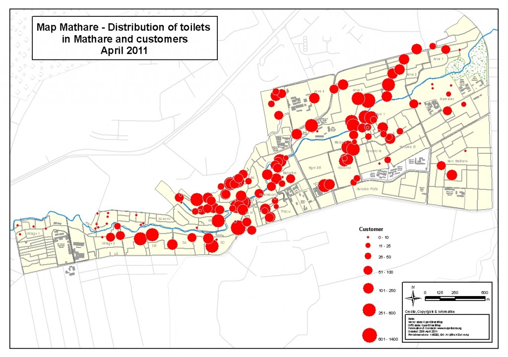
- We collected 144 points of interest where toilets are located in the whole of Mathare. These points have 373 individual units attached to them. These are mostly publicly accessible points, meaning we only took points which are public and, for example, didn’t walk into people’s homes.
- Most of these toilets are privately owned, with 50% of the toilets having known ownership. The other 50% are owned by different organizations, government, etc. and are considered public.
- The majority, 50%, of the toilets with known type are Asian Style, followed by 26% pit latrines, and 11% hanging toilets. The rest are trench and English toilets.
- Most of the toilets are located in the public within the communities; this is because we collected mostly public toilets in the first place. I’m happy to say that 90% of collected toilets are operational.
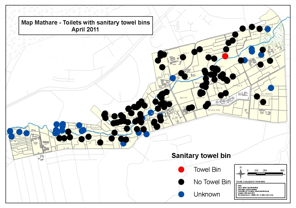
- Most toilets are connected to sewage (60%), and have available piped water (54%), and are usually cleaned, either by the operator (38%) or the caretaker (33%). Many toilets have almost non-existent hand washing accessories (37%) and non-existent towel bins (0,7%).
Couple of visualizations of the upper data displayed on maps:
Water points
- We collected 167 water points.
- 60% of these water points are privately owned. As with toilets, the rest are owned by different organizations, government etc. and are considered public.
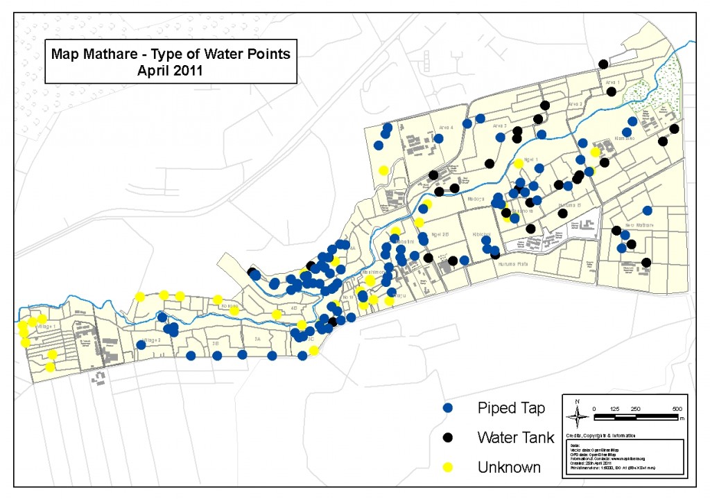
- Most of these water points are piped or tap water (75%), while others are water tanks.
- As with toilets, most of the water points are located in the public within the communities.
- 98% of collected water points are operational and have connection to water pipes.
A visualization of the upper data displayed on a map:
Open defecation areas
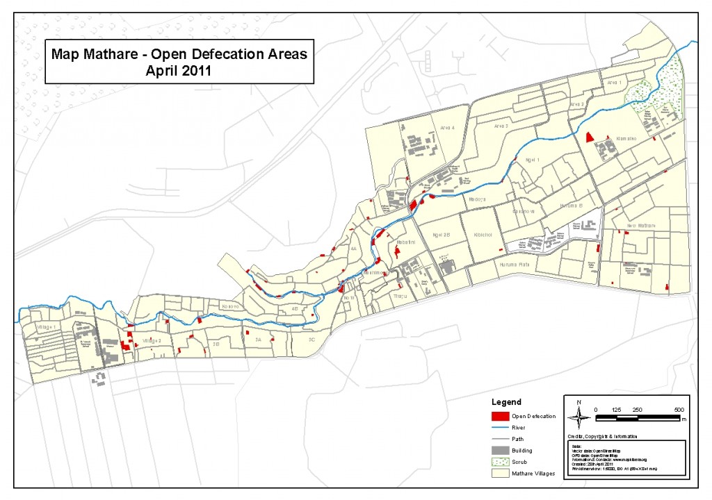
Open defecation areas cover 16144 m2 of Mathare (3 km2) and their placements vary throughout the slum.  They are mostly located in the areas where there are majority corrugated iron sheet houses, which usually don’t contain toilets.
More of the same on Mapping: No Big Deal


